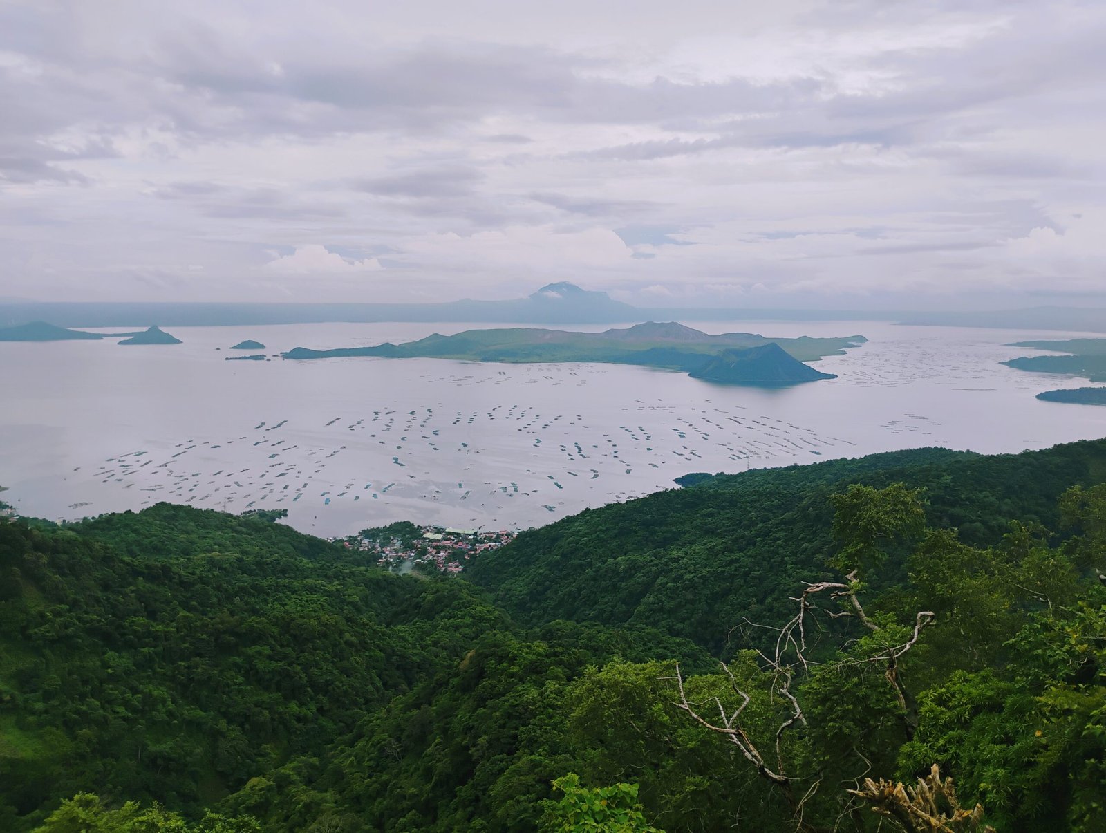
Fifteen kilometres from Anilao, there is a volcano inside a lake inside a volcano.
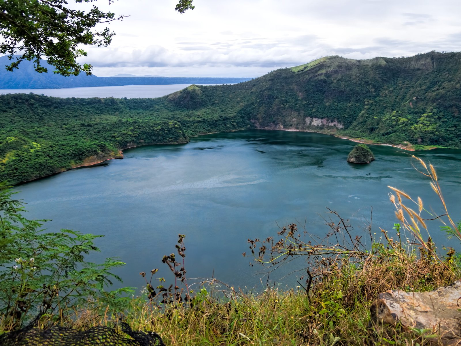
The outer volcano no longer exists as a mountain. It collapsed — four times, over hundreds of thousands of years — leaving a caldera 25 to 30 kilometres wide, now filled by Taal Lake. Within the lake sits Volcano Island, a jagged composite of cones and craters built up by eruptions within the flooded caldera. Within Volcano Island sits Main Crater Lake. And within Main Crater Lake sits Vulcan Point — a tiny island, the innermost doll of a geological Russian nesting set.
An island within a lake, within an island within a lake, within an island.
This is Taal Volcano — the most active volcano in the Philippines, one of the most dangerous in the world, and the engine that built the seabed where divers now come to see the richest reef on Earth.
The Mountain That Was
Before its caldera collapses, Taal was enormous. Geological analysis of the volume of material ejected during its major eruptions suggests the original stratovolcano may have stood 5,000 to 6,000 metres tall — comparable to Kilimanjaro. Today, the highest point of Volcano Island reaches 311 metres.
What happened to the rest of it is written in the rocks of Batangas.
Taal has experienced at least four caldera-forming eruptions — events so violent that the entire summit collapsed into the emptied magma chamber below. The largest, the Pasong Formation event, ejected an estimated 144 cubic kilometres of material — approaching the scale of eruptions classified VEI 7, comparable to Tambora in 1815 (the eruption that caused the “Year Without a Summer” across Europe). For context: Krakatoa in 1883 ejected roughly 25 cubic kilometres. Taal’s largest event was nearly six times that.
The ignimbrite deposits from these eruptions — dense, fast-moving flows of superheated gas and rock — extend outward from the caldera to the Tagaytay Ridge in the north and the Batangas coastline in the south and southwest. Anilao sits on this material. The dark volcanic sand at Secret Bay, the rubble where frogfish hide, the substrate where corals anchor — all of it is Taal’s ejecta, deposited by eruptions that reshaped the landscape before any human was present to see them.
When the Bay Became a Lake
Before 1754, Taal Lake was not a lake. It was an inlet of Balayan Bay — saltwater, connected to the sea by the Pansipit River, which was wide enough for Chinese junks and Spanish sailing ships to navigate inland.
Then Taal erupted.
The 1754 eruption — the largest in recorded Philippine history — lasted seven months, from May to December. Base surges crossed the lake at 80 kilometres per hour. Four towns were destroyed: Taal (then the provincial capital), Lipa, Tanauan, and Sala. The eruption deposited so much tephra into the Pansipit River that it was blocked entirely, severing the lake’s connection to the sea.
The lake surface rose. Monsoon rains diluted the salt water over decades. And the marine creatures that had been swimming freely between the bay and the lake were trapped.
The evolutionary consequences are remarkable. Tawilis (Sardinella tawilis) — the world’s only freshwater sardine — descended from marine sardines that couldn’t get out. It exists nowhere else on Earth. IUCN Endangered. The Taal lake sea snake (Hydrophis semperi) — one of only two true sea snakes in the world that lives entirely in freshwater — was similarly stranded. Bull sharks, which tolerate freshwater better than most marine predators, entered via the Pansipit and survived in the lake for generations before being hunted to extinction by fishermen in the early twentieth century.
A single eruption turned an ocean into a lake and created species that exist nowhere else in the world.
The Volcanic Reef
The connection between Taal and the reef at Anilao is not metaphorical. It is geological, geochemical, and measurable.
Substrate
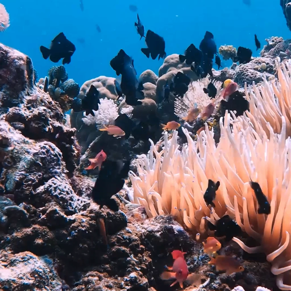
Volcanic rock makes excellent coral substrate. When Gunung Api in the Banda Islands of Indonesia erupted in 1988, andesitic lava covered the surrounding seabed in sterile rock. Within five years, marine biologists documented 124 species of coral colonising the fresh volcanic surface — a rate of reef establishment that confounded predictions. Volcanic rock is porous, rough, and mineral-rich. Coral larvae settle on it readily. The dark volcanic sand and rock formations around Anilao are the same material — Taal’s ejecta, providing the physical foundation for reef growth.
Nutrients
In 2023, researchers published a study in Science of the Total Environment that demonstrated what reef scientists had long suspected: corals exposed to moderate volcanic ash grow faster. Over a six-week laboratory experiment, coral fragments exposed to volcanic ash grew at twice the rate of controls. The mechanism: iron and manganese leaching from volcanic ash provide micronutrients that are typically limiting in ocean environments. The corals’ symbiotic algae (zooxanthellae) showed enhanced photosynthetic efficiency, higher chlorophyll levels, and improved biomineralisation.
Iron is an essential nutrient regulating productivity in roughly 30% of the ocean. Volcanic regions deliver it in abundance. The hydrothermal system beneath Taal — mapped by magnetotelluric surveys as a reservoir at least 3 kilometres across at 2.5 kilometres depth — feeds mineral-rich fluids through fracture networks that extend to the coast.
The Soda Springs
The most direct evidence of this volcanic plumbing sits on the seabed at Secret Bay.
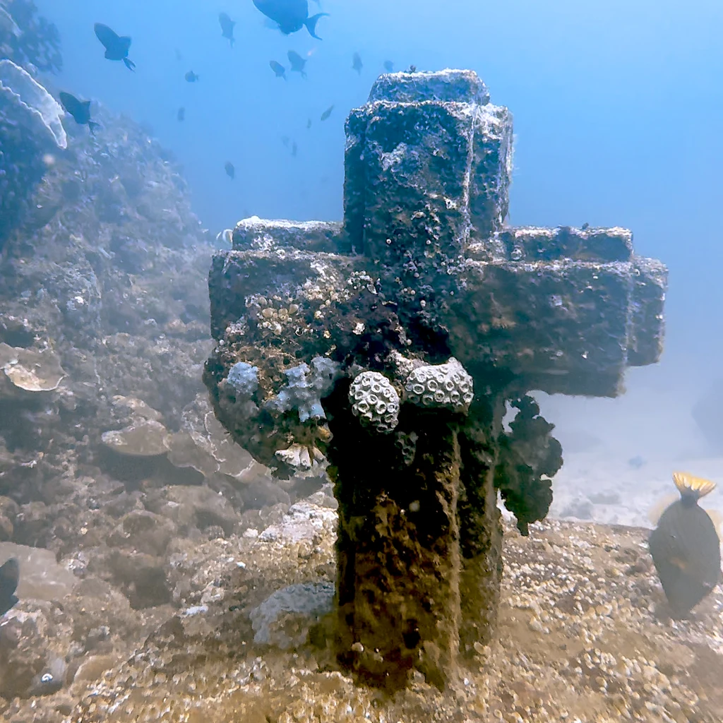
In 2020, Dr. M. Bayani Cardenas of the University of Texas at Austin — a Filipino scientist — documented submarine volcanic vents in Mabini, Batangas, that produce some of the highest CO2 concentrations ever recorded at any submarine vent worldwide: 95,000 parts per million — 200 times atmospheric levels. Water temperature at the vents reaches 60 degrees Celsius. The pH drops to 5.4 to 6.0 — acidic enough to dissolve shell.
These vents are fed by magmatic CO2 percolating laterally through fracture systems from Taal’s subsurface plumbing. When Taal’s activity increases, the springs produce more bubbles. The connection between the volcano and the sea is not abstract — it’s a measurable flow of gas and heat from a magma chamber to a dive site.
And here is the remarkable part: corals grow within metres of these vents. A 2024 study published in Regional Studies in Marine Science documented coral recruitment of 45 to 73 recruits per square metre at the Mabini shallow hydrothermal vents — in conditions that model what the world’s oceans may look like under future acidification scenarios. The species are stress-tolerant, the colonies small, but they are there. Growing. In water that should, by conventional understanding, dissolve them.
Divers at Secret Bay can see the bubbles rising from the sand. They are diving on the interface between a supervolcano and a reef — watching CO2 from a magma chamber percolate through the seabed while nudibranchs crawl over volcanic rubble and frogfish wait in ambush on volcanic sand.
What Doesn’t Hold Up
It would make a neat story to say that Taal Volcano is the reason the Verde Island Passage is the most biodiverse marine ecosystem on Earth. The story would be wrong — or at least, incomplete.
The primary drivers of the passage’s extraordinary biodiversity are well-documented: its position at the convergence of ocean basins, the current systems that funnel through its narrow corridor, the Philippines’ location within the Coral Triangle, and the biogeographic overlap of species from the South China Sea, the Pacific, and the Indian Ocean. These factors would produce exceptional biodiversity with or without a volcano nearby.
What the volcano adds is substrate, nutrients, and complexity. Volcanic rock provides excellent settlement surfaces for coral larvae. Volcanic minerals provide iron and manganese that enhance coral growth. Hydrothermal activity creates microhabitats — the acidified vents, the warm spots, the mineral-rich seeps — that increase the environmental diversity of an already diverse ecosystem. And the dark volcanic sand that characterises Anilao’s muck sites provides the specific habitat where many of the area’s most famous critters — the frogfish, the octopuses, the ghost pipefish — are found.
Taal didn’t create the biodiversity. But it built the stage on which it performs.
2020: The Volcano Returns
On 12 January 2020, Taal erupted for the first time from Main Crater since 1911 — a gap of 109 years. A sub-Plinian eruption column rose 17 to 21 kilometres. Volcanic lightning crackled through the ash plume. Ashfall reached Metro Manila, 65 kilometres away. All flights at Ninoy Aquino International Airport were suspended. Over 500,000 people were affected. Agricultural damage exceeded 3 billion pesos.
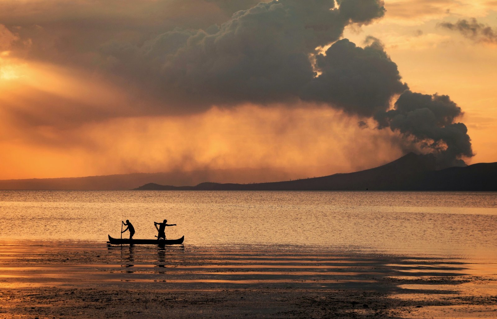
And in Anilao, 15 kilometres from the erupting volcano, Blue Ribbon Dive Resort posted an update: “Business as usual.”
The ashfall in Anilao was light. Visibility underwater was unaffected. The reefs showed no measurable damage. The thickest deposits fell north of the lake — Agoncillo, Laurel, Lemery — while the Calumpan Peninsula, sheltered by geography and wind direction, received a dusting that the currents quickly cleared.
The resort’s experience mirrors the broader scientific picture: moderate volcanic ash exposure may actually benefit coral reefs in the short term, providing a pulse of iron and other micronutrients. The Verde Island Passage’s powerful currents would have dispersed and diluted any localised impacts within days. If anything, the reef got a mineral supplement.
Taal remains at Alert Level 1 as of early 2026 — low-level unrest, localised swelling, routine SO2 emissions. The volcano is never truly quiet. It has erupted 33 times since the Spanish first recorded it in 1572. It will erupt again. The reef will still be there when it does.
The View from the Cafe
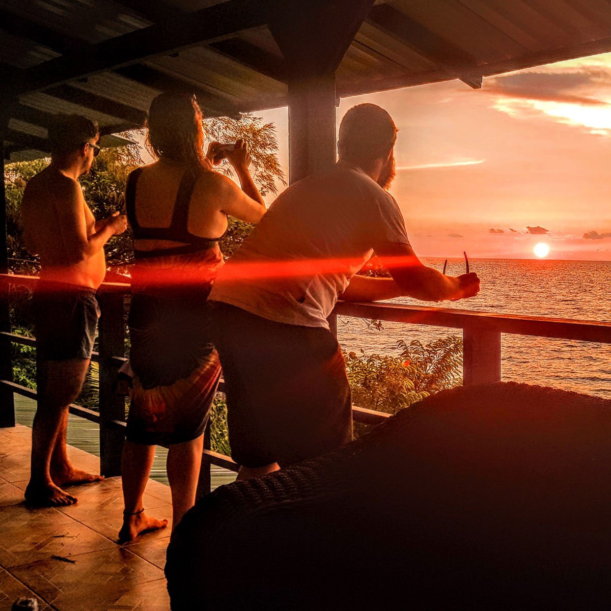
Blue Ribbon Dive Resort sits on the western shore of Anilao, looking out across Balayan Bay. On a clear morning, you can see the rim of the Taal caldera from the cafe — the ridge that marks the edge of a mountain that used to be 5,000 metres tall and is now a lake.
The children of Mabini grow up on volcanic soil, eating fish from volcanic reefs, finding glittering flakes of biotite mica on dark volcanic beaches. Rhianna, who manages the resort, collects crystals and minerals from the local geology — chalcedony geodes, iron-stained quartz, porphyritic basalt with feldspar phenocrysts that look like stars frozen in dark rock. Each specimen is a fragment of Taal’s history: different cooling rates, different mineral compositions, different moments in the life of a volcano that has been building and destroying itself for hundreds of thousands of years.
The reef that draws divers from around the world grows on this volcano’s output. The sand they kneel on during muck dives is volcanic sand. The rock where coral anchors is volcanic rock. The minerals that feed the zooxanthellae in the coral tissue come from volcanic hydrothermal systems. The bubbles rising from the seabed at Secret Bay are volcanic gas.
Fire built this reef. It will reshape it again. And in the meantime, it sustains one of the most extraordinary ecosystems on the planet — fifteen kilometres from an active volcano, two hours from Manila, in a narrow strait that the rest of the world is only beginning to understand.
Blue Ribbon Dive Resort is located in Anilao, Mabini, Batangas — fifteen kilometres from Taal Volcano, on the shore of the Verde Island Passage.
Sources
1. Delos Reyes, P.J. et al. (2018). “A synthesis and review of historical eruptions at Taal Volcano.” Earth-Science Reviews.
2. Cardenas, M.B. et al. (2020). “Submarine Groundwater and Vent Discharge in a Volcanic Area Associated with Coastal Acidification.” Geophysical Research Letters.
3. Maningas, Ticzon & Rodriguez (2024). “Characterization of coral communities in the shallow hydrothermal vents of Mabini, Batangas.” Regional Studies in Marine Science.
4. Forster, T. et al. (2023). “Increased coral biomineralization due to enhanced symbiotic activity upon volcanic ash exposure.” Science of the Total Environment.
5. Tomascik, T. et al. (1996). “Rapid coral colonization of a recent lava flow.” Coral Reefs.
6. Zlotnicki, J. et al. (2017). Magnetotelluric surveys of Taal. Journal of Volcanology and Geothermal Research.
7. Yamaya, Y. et al. (2013). “A large hydrothermal reservoir beneath Taal Volcano.” Bulletin of Volcanology.
8. Carpenter, K.E. & Springer, V.G. (2005). “The center of the center of marine shore fish biodiversity.”
9. PHIVOLCS-DOST — Taal Volcano advisories (2020-2026).
10. Smithsonian Global Volcanism Program — Taal Volcano entry.
11. IUCN Red List — Sardinella tawilis (Endangered).
12. Blue Ribbon Dive Resort — “Taal Volcano Update: Business as Usual.” (2020).
13. VolcanoCafe — “A Taal Tale.” Pre-caldera height estimates.